Batam has a long history dating back to the 3rd century AD, until it developed rapidly in the modern era as a center of industry, trade and investment in Indonesia.


Batam is part of the Riau Islands Province located on the strategic route of Southeast Asia, directly adjacent to Singapore and Malaysia. With an area of ± 415 km², Batam has become one of the most important industrial and trading cities in Indonesia.
Batam has a tropical climate with two main seasons: dry (March-September) and rainy (October-February). The average temperature ranges from 26-34°C throughout the year.
Has an area of 251,810.71 km²
It is located 550 km to the Northeast of Batam Island, with an area of 1,720 km2 (172,000 Ha).
It has an area of 415 km2 (41,500 Ha).
It is located 2.5 km to the Southwest of Batam Island, with an area of 100 km2 (10,000 Ha).
It is located 20 km to the northwest of Batam Island, with an area of 674 km2 (67,400 Ha).
It is located 2.5 km to the Southeast of Batam Island, with an area of 165.83 km2 (16,583 Ha).
It is located 10 km to the East of Batam Island, with an area of 1,100 km2 (110,000 Ha).
Located 350 m to the southeast of Rempang Island, with an area of 80 km2 (8,000 ha).
Batam Island, Rempang, Galang and surrounding islands have an area of 715 km2 (71,500 ha).

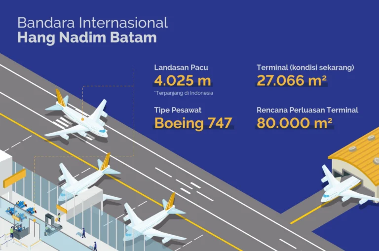
An international airport with the longest runway in Indonesia, it is the main door for air transportation and connects Batam with major cities in Asia.

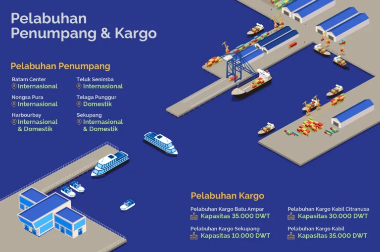
The main port for export-import activities, serving industrial logistics, trade, and being a strategic path of maritime connectivity.

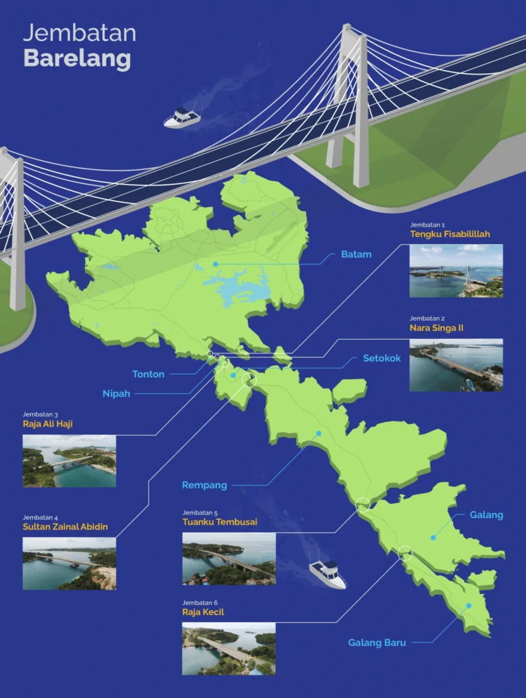
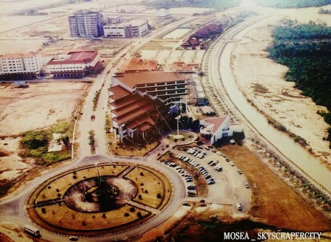
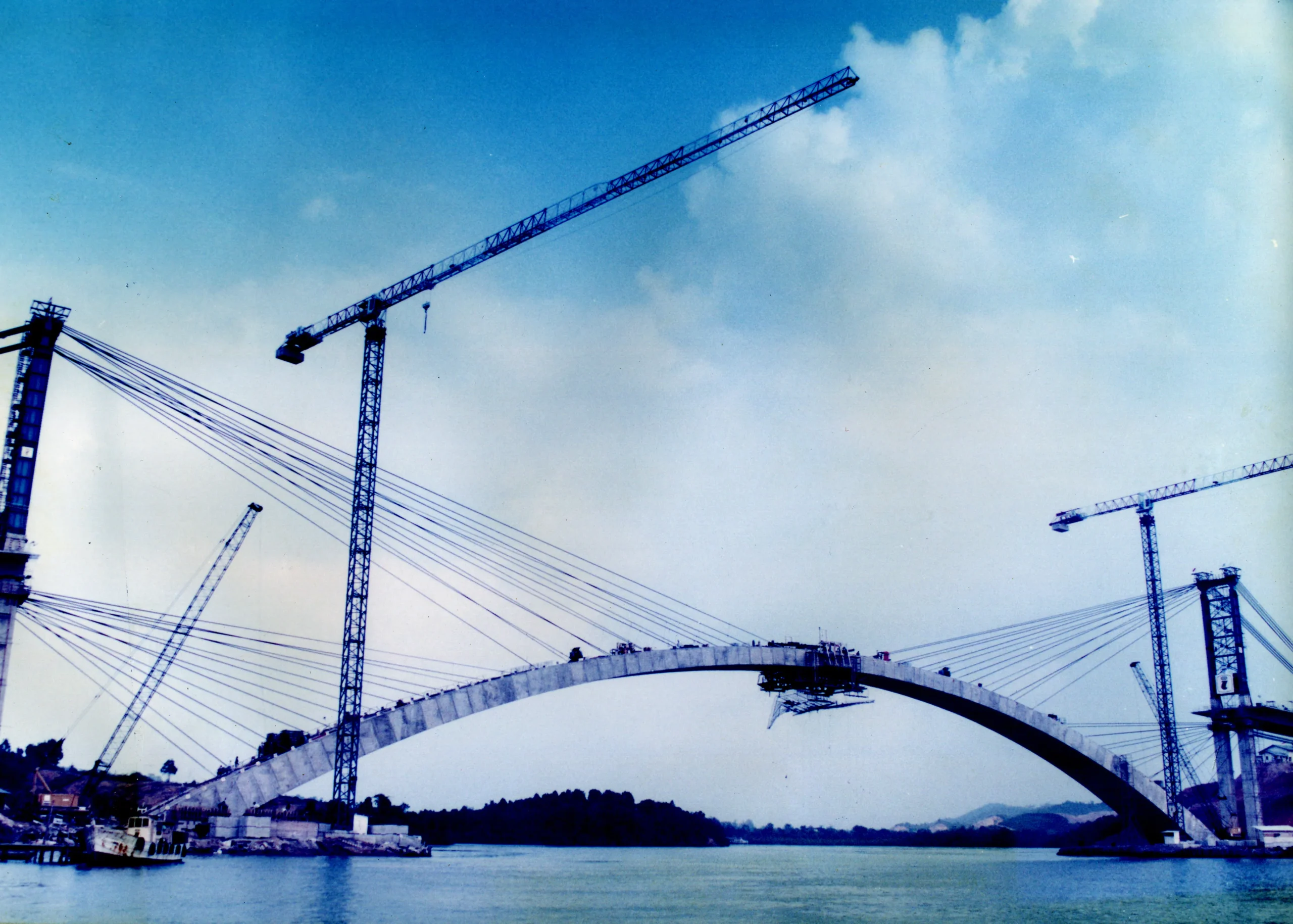
The icon of Batam city that connects Batam, Rempang, and Galang islands, as well as a tourist destination and symbol of the city's infrastructure development.

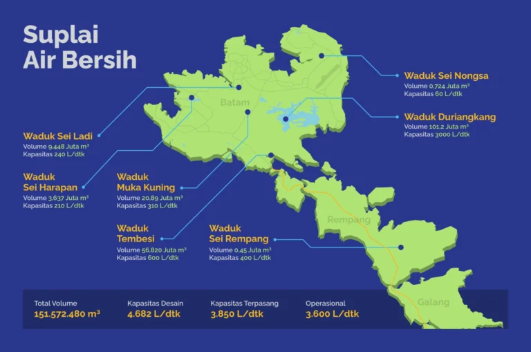
SPAM Batam manages a modern clean water distribution system that covers the entire main island. This infrastructure ensures that the needs of households, public facilities, tourism, and industrial areas are met in a sustainable manner.
Temukan layanan, Berita, atau informasi publik.