
As a national strategic area as well as Indonesia’s investment gateway at the global level, Batam has a great responsibility in ensuring spatial governance that is adaptive to the pace of economic growth and infrastructure development. Good spatial planning is not only related to the provision of land for investment, but also includes a balance between economic, social and environmental functions.
Within this framework, the Deputy of Land, Coastal and Reclamation Management of BP Batam is one of the main pillars in ensuring that every spatial utilization policy is implemented in an efficient, inclusive and sustainable manner. Consisting of the Directorate of Land Management, Directorate of Coastal Area Management and Reclamation, Directorate of Land, Coastal Area Management and Reclamation Control, this Deputy is tasked with formulating policy direction, conducting technical arrangements, and overseeing the implementation of comprehensive land, coastal area and reclamation management programs.
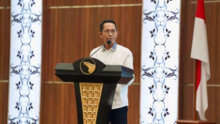
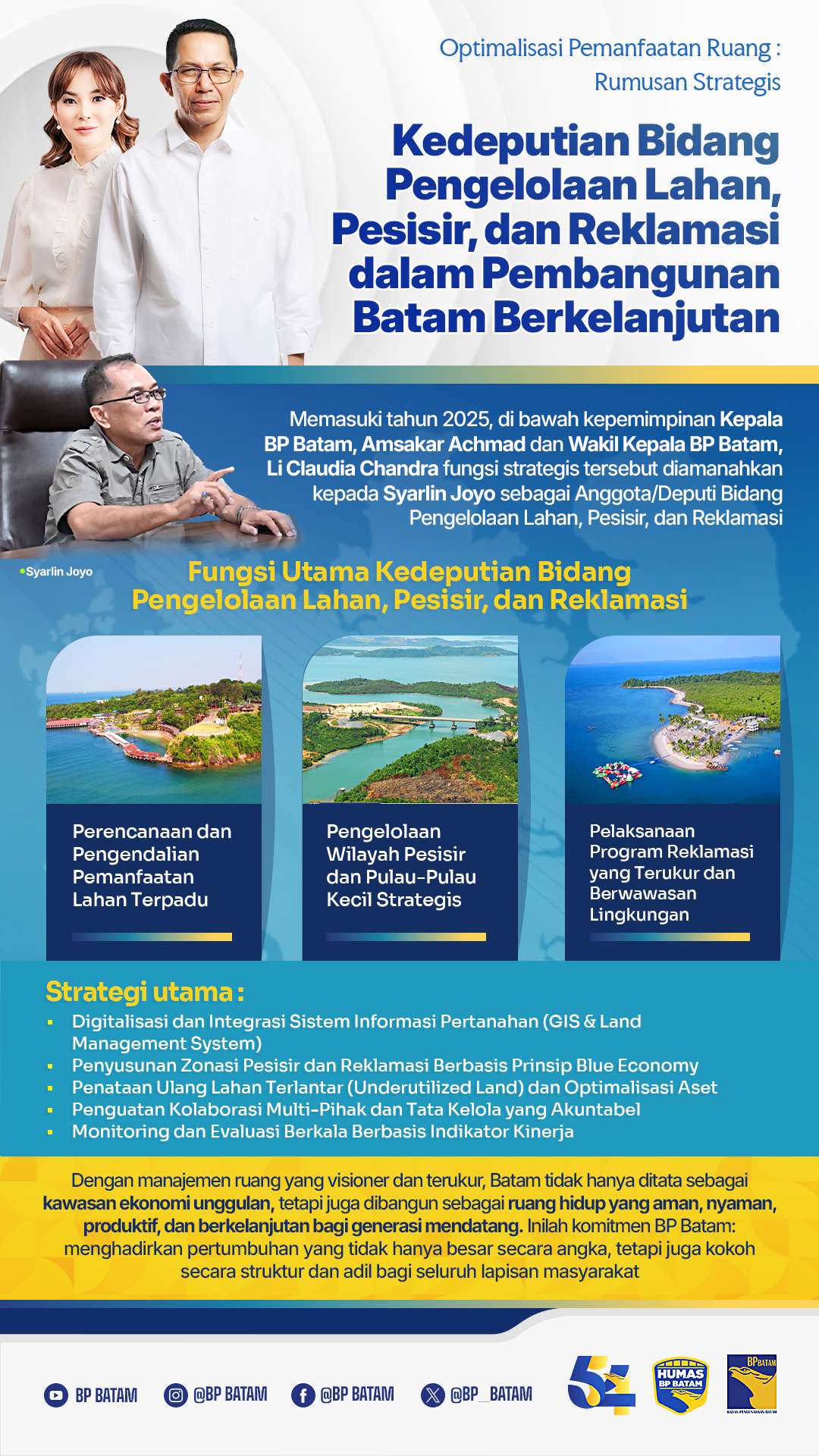
Entering 2025, under the leadership of the Head of BP Batam, Amsakar Achmad and Deputy Head of BP Batam, Li Claudia Chandra, this strategic function is entrusted to Syarlin Joyo as Member/Deputy of Land, Coastal and Reclamation Management. He is entrusted with optimizing spatial planning and control amidst the increasing demand for land for industry, logistics, modern settlements, and large-scale public infrastructure. With a data-driven approach, regulation, and cross-stakeholder collaboration, the Deputy is expected to deliver an orderly, productive, and environmentally friendly Batam spatial planning.
Main Functions of the Deputy for Land, Coastal, and Reclamation Management
In order to realize measurable and competitive spatial governance, Syarlin Joyo as Member/Deputy of Land, Coastal and Reclamation Management carries out strategic mandates that include:
- Integrated Land Use Planning and Control
Covers the process of preparing spatial plans, harmonizing them with central and regional policies, and monitoring their implementation. The main focus is:
- Provision and allocation of land for priority industrial areas, integrated settlements, public facilities, and strategic infrastructure (such as ports, energy, transportation networks).
- Improvement of a digital-based land licensing system (land management system) to increase transparency and legal certainty for investors and the public which can be accessed through lms.bpbatam.go.id.
- Supervision of landholder compliance, including evaluation of productive land use and curbing idle land to ensure utilization in accordance with permits and designations.
- Management of Strategic Coastal Areas and Small Islands
As an archipelago, Batam has a vital position in coastal management to support the logistics, fisheries and tourism sectors. In this context, the Deputy for Land, Coastal and Reclamation Management has a duty:
- Develop a Coastal and Small Island Zoning Plan (RZWP3K) that regulates the utilization of marine and aquatic areas based on ecological, economic and social functions.
- Develop a maritime economic area based on the blue economy, through the arrangement of fishing ports, marine tourism, and marine logistics terminals in a sustainable manner.
- Securing and monitoring territorial boundaries and preventing illegal activities such as unauthorized reclamation, illegal dumping, or mangrove ecosystem encroachment.
- Implementation of a Measured and Environmentally Sound Reclamation Program
Reclamation in Batam is not only aimed at expanding land, but also to address the long-term needs for investment space and infrastructure. Therefore, its implementation must fulfill the principles:
- Planning based on AMDAL studies and carrying capacity, ensuring reclamation does not damage the quality of marine and coastal ecosystems.
- Synchronize with regional master plans so that reclamation results are integrated with utility infrastructure, road networks, and new economic areas.
- Strict supervision of reclamation implementers, including technical requirements for embankment, land maturation, and handover of reclamation results according to approved specifications.
Supporting Statistical Data
The Batam Concession Agency (BP) has a fairly large working area, covering land, waters, protected forest areas, and mangrove ecosystems, with a total area of around 73,239 hectares. Of this amount, there are about 42,227 hectares of land that can be submitted in the form of Land Management Rights (HPL).
When broken down by island and area unit, Batam Island has the largest area with a total of 46,192 hectares, of which 28,752 hectares have HPL status. Rempang Island contributes 14,039 hectares (with 7,147 hectares of HPL), while Galang Island has an area of 8,188 hectares with 3,468 hectares of HPL. Galang Baru Island is 3,030 hectares with 1,534 hectares of HPL, and small clusters such as Janda Berias and its surroundings are 241 hectares with 110 hectares of HPL.
In the urban context, one of the main challenges is the existence of slum areas, which by 2024 are recorded at 1,226.31 hectares. Meanwhile, the population of Batam City at the end of 2023 reached 1,260,785 people, showing the dynamics of rapid urbanization.
Geographically, the land area of Batam covers about 715 km², with the total area, including the sea and surrounding areas, reaching ±1,575 km².
From the above data, it appears that only a portion of the total area of BP Batam can actually be managed optimally (HPL). This emphasizes the need for selective and focused policies in the allocation of productive land.
As a foundation in realizing orderly and competitive spatial governance, the Deputy for Land, Coastal and Reclamation Management sets a number of main strategies that become the direction of policy implementation in the field, namely:
- Digitization and Integration of Land Information System (GIS & Land Management System)
The strengthened digital system is used to map all land parcels and coastal areas in real-time and accurately. Through the integration of spatial data, administration, and licensing, the land allocation process becomes more transparent, efficient, and can reduce overlapping claims and land abuse.
- Coastal Zoning and Reclamation Based on Blue Economy Principles
Management of marine and coastal areas is directed towards a balance between economic utilization and ecosystem protection. Every reclamation project must go through environmental assessment and synchronization with spatial plans, so that the economic benefits are directly proportional to ecological sustainability.
- Reorganization ofUnderutilized Land and Optimization of Assets
BP Batam’s internal analysis shows that there are hundreds of parcels of land that have not been utilized productively. Through an inventory process, licensing evaluation, and reassignment or revitalization mechanisms, these lands are redirected to support investment needs and public facilities.
- Strengthening Multi-Stakeholder Collaboration and Accountable Governance
The implementation of space utilization involves close coordination between the central government, local governments, business actors, communities, and supervisory institutions. Input from institutions such as the Ombudsman of the Republic of Indonesia Representative of the Riau Islands is an important part of improving the transparency and integrity of land services.
- Periodic Monitoring and Evaluation Based on Performance Indicators
To ensure the effectiveness of the policy, the Deputy implements a periodic evaluation mechanism with measurable indicators, among others:
- Percentage of active and productive land
- Level of conflict or land dispute resolution
- Compliance with environmental and spatial standards
By consistently and measurably implementing the above strategies, BP Batam affirms its commitment to make spatial utilization the main instrument in encouraging investment, improving the quality of life of the community, and creating sustainable growth.
Going forward, the policy direction and formulation of spatial utilization prepared by the Deputy for Land, Coastal and Reclamation Management will be an important foundation for various major development agendas in Batam. From the development of Rempang as a new investment area, the expansion of a green industrial area with global standards, to the development of a modern port and world-class logistics connectivity network – all require a mature and adaptive spatial foundation.
With visionary and measurable spatial management, Batam is not only organized as a leading economic region, but also built as a safe, comfortable, productive and sustainable living space for future generations. This is BP Batam’s commitment: to bring growth that is not only big in numbers, but also structurally sound and fair for all levels of society.